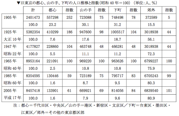
Below see some interesting tables I have found in a recent research report and of which I want a record, and why not on this blog? They are about Tokyo’s population distribution in and outside of the 23 wards. Nothing earth-shattering, but some ideas on how to present data at the very least. An interesting graph on land price increases concludes this post.
Category Archives: Tokyo
Tokyo housing supply
Tokyo’s skyline is set to see 45 new skyscrapers by the 2020 Olympics, Bloomberg reports. Such heightened construction activity is seen as evidence of 1) the effectiveness of Abenomics, 2) building regulations that encourage new construction and 3) a generally competitive rental market that leads to lower rents. How much truth is there in this?
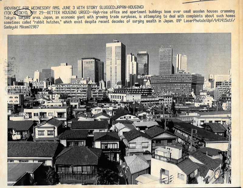
Thirty years and nothing changed?
Arakawa-ku trip
We took the Toden Arakawa line this weekend. It is Tokyo’s last remaining tram car service, connecting Waseda with Minowabashi in Arakawa-ku. A few pictures after the jump.
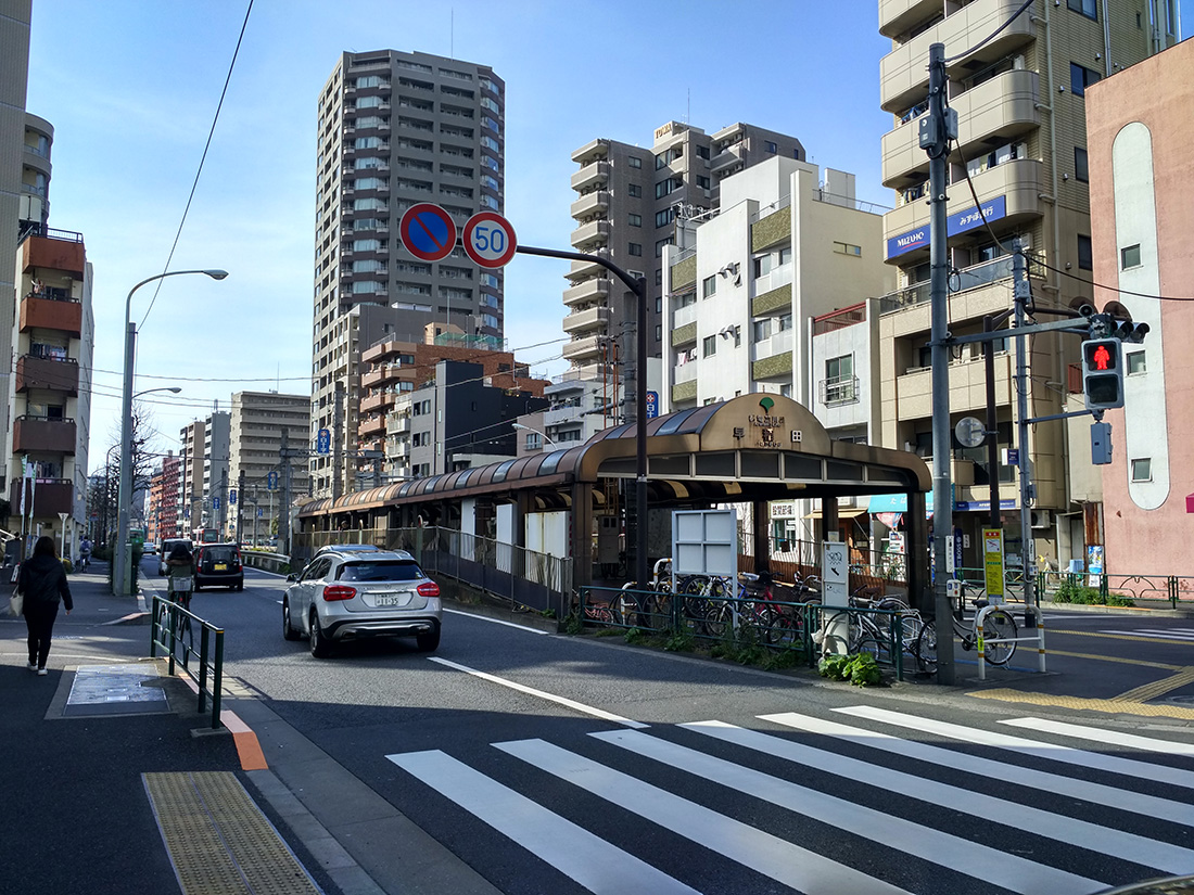
Getting on the tram at Waseda
Urban inequalities
Just how does space influence economic outcomes, and vice versa? A good example of how causality can run both ways comes from the realm of economic inequalities.
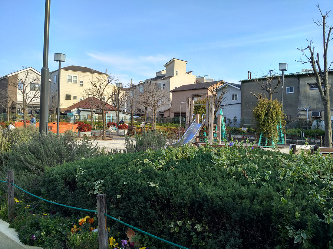
A former substandard housing district long turned into a public park in Arakawa-ku
Tokyo’s expansion seen from the 70s
This interesting paper was published in Comprehensive Urban Study (sogo toshi kenkyuu) in 1978. Its two parts (one written in 1972 and the other in 1977) talk about the recent expansion of Tokyo, specifically to do with its increasing suburbanisation. It features some great maps of which I feature some in this post.
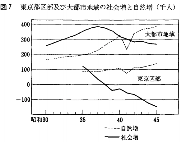
Decomposing the population change in the Tokyo Metropolis between 23 wards and the rest as well as natural and social increase/decrease
On space
As written about several times on this blog, my current doctoral research focuses on Tokyo’s postwar economic history. I want to establish space as an independent variable in understanding economic outcomes.
House in Higashiyamato
Tokyo density revisited
I stumbled upon an interesting blog post on Market Urbanism from a few years ago that talks about Tokyo’s surprising lack of density. I would disagree somewhat with that statement. More below the jump.
Tokyo towards the West as seen from Shinjuku
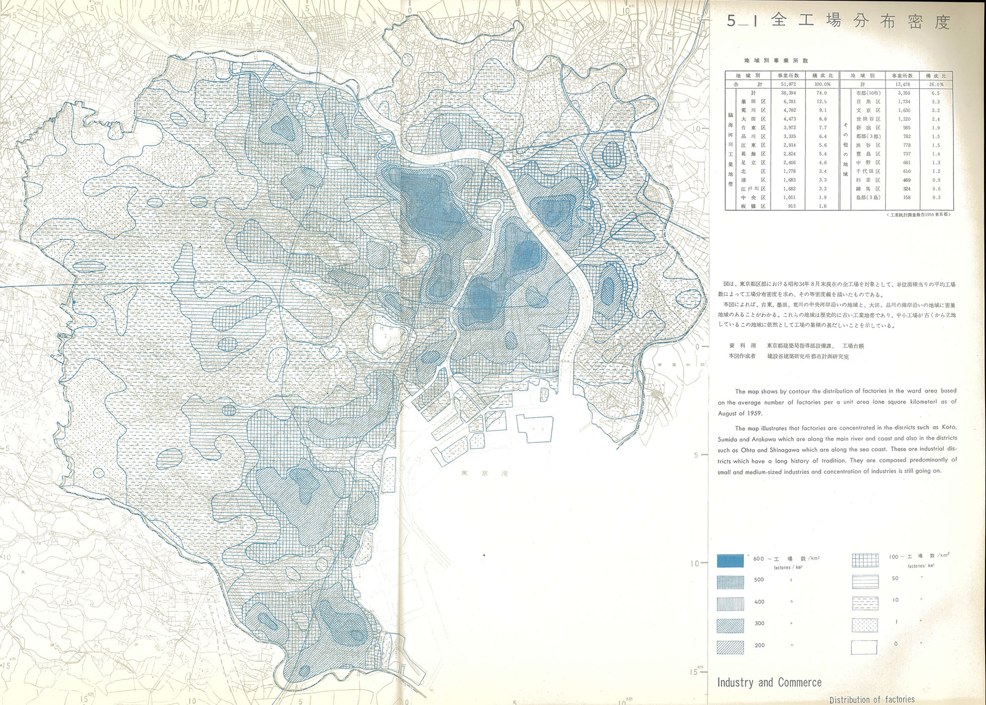
Vintage GIS: urban manufacturing
The treasure trove that is the 1961 TMG urban planning atlas has two fascinating maps on the distribution of factories and their growth. They show that the traditional areas of industrial activity are also attracting most of the growth in new factories.
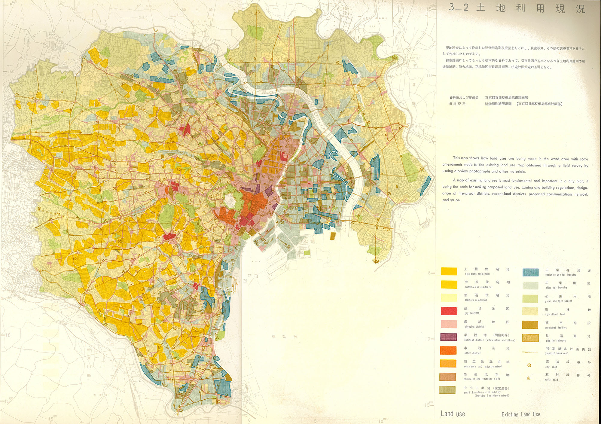
Vintage GIS: zoning and land use
With two maps in tow, I look at Tokyo’s land use and zoning in the late 1950s. Zoning designations largely reflected then-current land uses, except for some visionary (and eventually never realized) ideas about greenbelts and decongestion.
Postwar Tokyo in maps
As I go through the TMG publication I referred to in this previous post, herewith some links to maps of historical Tokyo for my and everyone else’s reference. Please feel free to supplement this with your own links in the comments, I will add to the post.
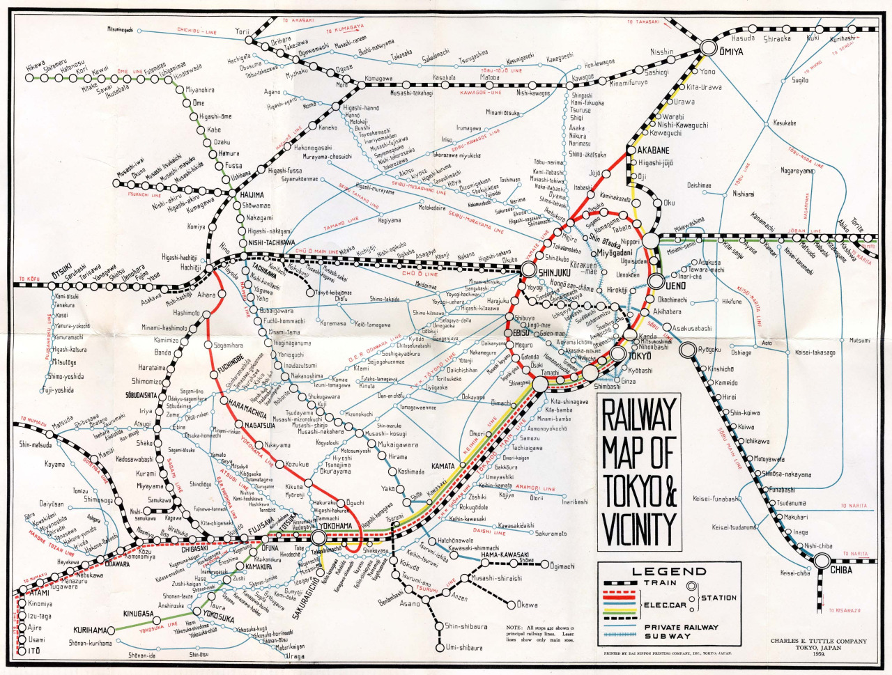
1959 railway map, from Flickr user Rob Ketcherside