As I go through the TMG publication I referred to in this previous post, herewith some links to maps of historical Tokyo for my and everyone else’s reference. Please feel free to supplement this with your own links in the comments, I will add to the post.
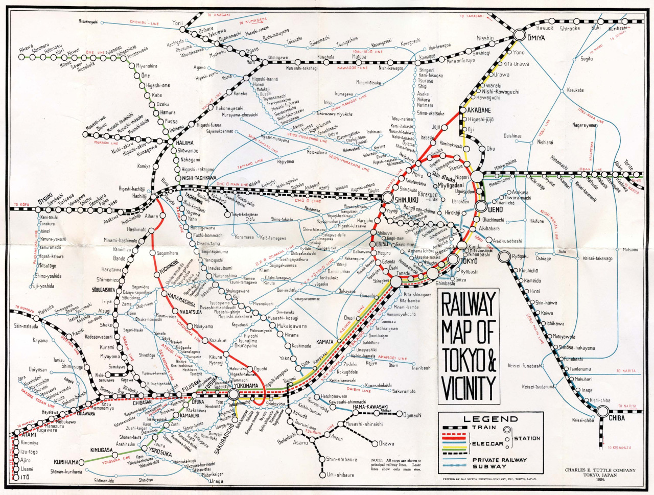
1959 railway map, from Flickr user Rob Ketcherside
- This here is an interactive map with superimposed aerial photo layers from both 1947 and 1963. These are two really interesting years from a historical point of view. The former because you still see a lot of the bomb damage two years after the end of the war, and the latter because it is on the eve of the Olympics, with a lot of Games-related construction ongoing.
- Plenty of maps are hosted on ArcGIS, including this one here on Tokyo’s historical boundaries. It shows the exceptional growth in urban footprint that took place between 1954 and 1972, for example.
- Using the ArcGIS platform, the University of Tokyo has digitized a 1965 population atlas, with detailed views on population density (the digital version of the image in my previous post), household size, sex ratio and three maps incorporating occupational data (ratio of secretaries, white collar and blue collar, to total workforce, respectively). Fascinating stuff.
- (On population density, their highest category is 30,000+ inhabitants per sqkm, which is a bit unfortunate as some select areas go up as high as 45,000+ as can be seen from the map in my previous post). It would be great to see some more granularity for the high-density areas. I will try to get my hands on the source data.)
- My own Postwar Japan Tumblr page has quite a few mainly English language maps, although beyond their aesthetic value their use is rather limited. My favorites are this 1948 roadmap as well as this 1959 railroad map.
- The Nichibunken website has a treasure trove of detailed historical documents, including zoomable 1960 maps of Toshima, Taito and Shibuya. There are also the 1956 maps of Bunkyo, Toshima, Taito, Kita and Arakawa. More ward-level maps from 1947 are available via the index page. There is also an overall city map from 1955 here.
- This 1950 map on water supply and canals provides a fascinating glimpse into the physical infrastructure of the postwar city. This one here from 1946 is a plan on the creation of green spaces.
- The “new” 23 wards as per the 1947 postwar reform are each shown on these maps, which are also hosted on the Nichibunken website. A Tokyo-wide map with the new wards is here. Their boundaries are superimposed on a contemporary map of Tokyo here, very useful.
- A 1956 interactive map is available on the Mainichi website, replete with a current map overlay that is scalable in its transparency as well as photo links.
- I am sure plenty of offline special map requests can be met here in the Tokyo Metropolitan Library, their collection looks very promising.
