Owing to the popularity of my post from the other day I thought I’d assemble some more “Tokyo: before and after” shots. What follows are images that illustrate how Marunouchi has been transformed over the decades. Another example, my personal favourite, shows the area east of Shinagawa.
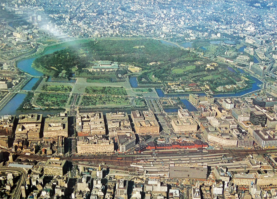
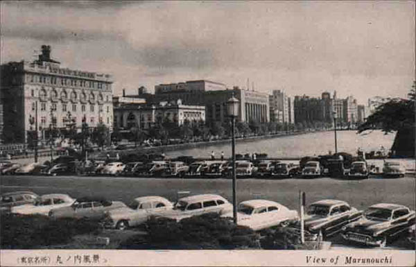
This postcard from 1970 (it can be yours on ebay!) shows the Marunouchi business district photographed towards the west. We overlook Tokyo Station and the Imperial Palace Gardens. Although building height restrictions had already been lifted a few years before, no high-rise has yet been built in this particular area of Tokyo (the first one was to be Mayekawa’s 1974 Tokyo Marine and Fire Insurance Company building).
Unfortunately I didn’t get reprint permission for the “after” shot, but you can look at it here on nipponnews. A Google Earth rendition is here.
The whole area is now reaching for the sky and has one of the highest densities of skyscrapers, with new construction happening as we speak. Marunouchi’s orderly street grid allows perspectives one only knows from planned cities such as New York. In fact, even before the building height limitation was scrapped, the area was known as the “New York block”.

Tokyo Station will celebrate the 100th anniversary of its opening next year. A lot of money went into restoring the building to its former glory. I looks like the area behind the station, Nihonbashi, already maxes out the permissible height of 100 feet when the photo for the postcard above was taken, probably in the early 1960s.
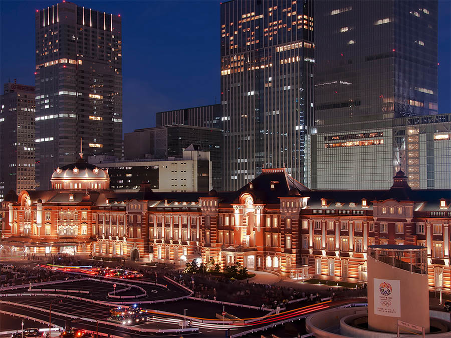
Photo courtesy of Duane / Suzuki-san on flickr, reprinted with permission
Today again it’s a completely different picture, with skyscrapers dwarfing the old classical station building. New developments are ongoing on all corners, continuously changing the appearance of the whole area.
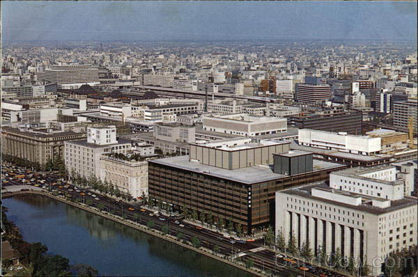
Looked at from the east, Marunouchi has always appeared rather orderly. A long and straight moat separates the area from the Imperial Garden and has seen a row of buildings line up on its side, Hibiya Dori. Above postcard is probably from the early 1960s as well.
On the right is the Dai-ichi Seimei (1938), in which the Supreme Command of the Allied Powers had their headquarters during the Occupation period. On the very left is the Meiji Seimei-kan (1934), recognisable by its long columns.
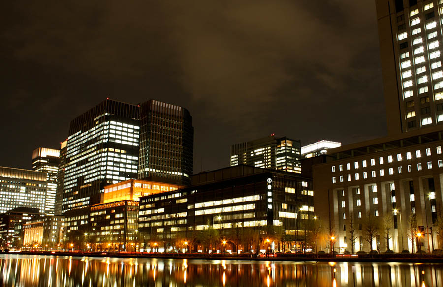
Photo courtesy of mylo73 on Flickr, reprinted with permission
Today, the uniform building height has completely vanished, yet the street facing the moat still has an orderly impression to it. That’s also thanks to the fact that some buildings have not been torn down, but rather used as the pedestal for vertical extensions. On the right, this can be seen with the DN Tower 21 Building, where a 21-storey office building was put on top of the existing structure in 1995. Here is another shot on Flickr that can be compared to the postcards.
The view from the northeastern side shows the same transformation. The above postcard, judging from the cars, dates back to the 1950s. We can see the Meiji Life Insurance Building (with the columns) in the middle.

A lot had already changed by the 1970s, from where the above postcard appears to be from. Buildings previously standing to the left of the Meiji Building are torn down and made space for new developments.
Again I didn’t get reprint permission for the two photos I wanted to show here, but you can open them yourself here and here. They show today’s view from roughly the same position. The staggered style in which some of Marunouchi’s old buildings got “preserved” while not standing in the way of vertical progress can be seen very well here.

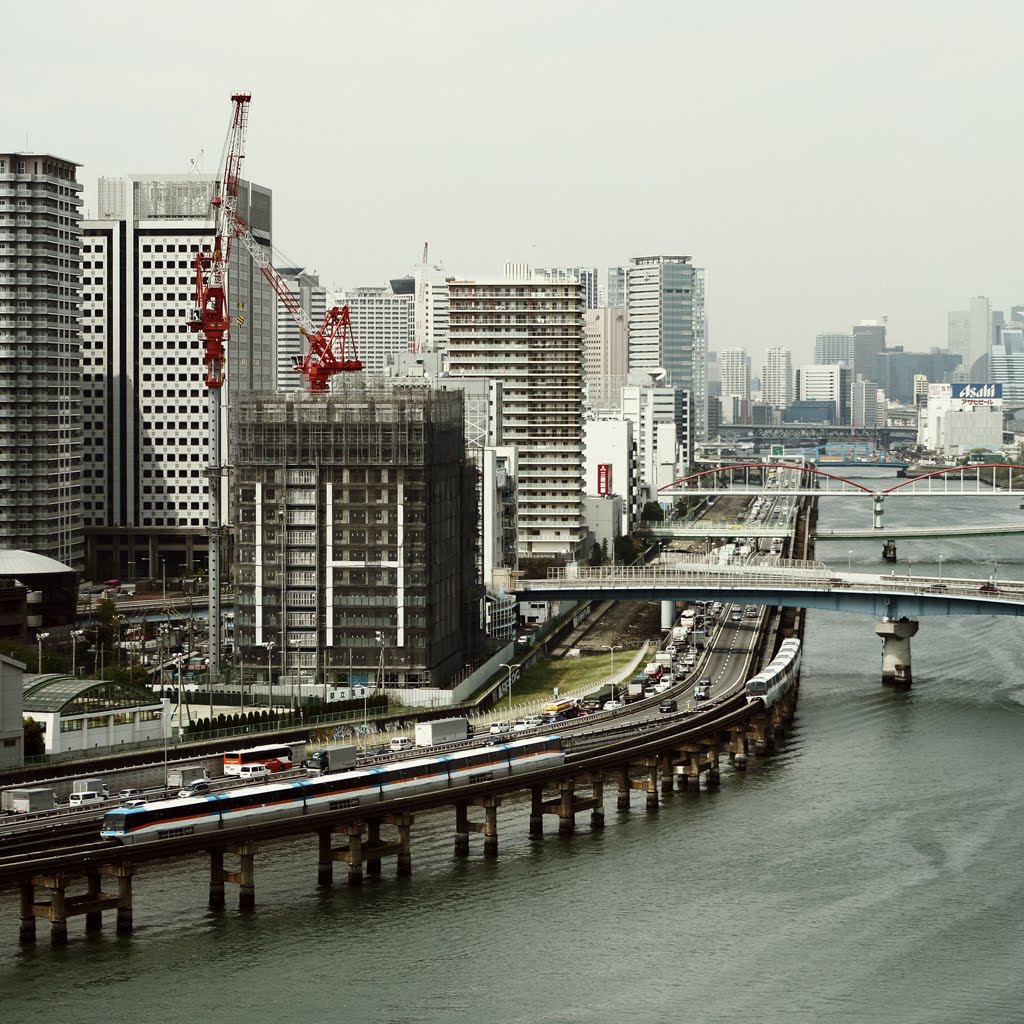
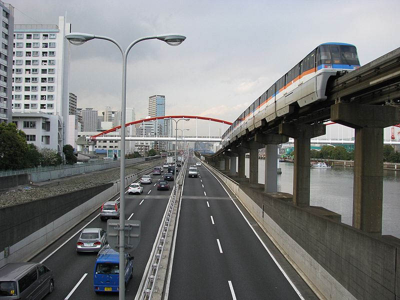
The slide above dates back to an airplane photo session in 1964. We look towards the north along the Shuto Kosokudoro Route 1 leading from the city centre to Haneda airport. The brand-new monorail, opened in time for the Olympic games, goes in parallel.
Land reclamation in the Tokyo Bay was in full swing by the 1960s. Yashio, the man-made island on the right, looks like it was still being drained at the time the photo was taken, while the island above it already had a power plant built on it. The map on page 7 of this great paper illustrates the chronology of land reclamation.
This was the route visitors from overseas took when arriving in Tokyo for the Olympics 1964. From the window of the taxi, the view still adhered very much to today’s typology of a developing country. The ambition and scale of the Japanese developmental trajectory, however, became visible very easily, not the least in the monorail and the brand-new Shuto expressway but also in the huge terraforming exercise underway in Tokyo Bay.
Alas, as the above was taken from the inside of a plane, there really is no equivalent shot from today (at least that I can find). However, technology helps a little, and fiddling with Google Earth allows for a fairly decent reproduction of how a similar shot today would look like:
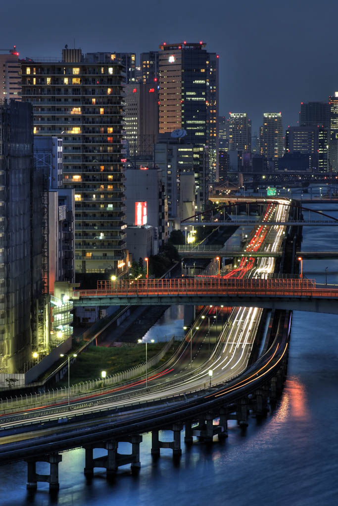
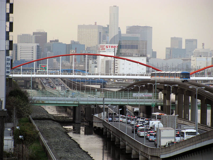
More photos from that particular stretch of the Haneda-bound shuto:
The two images above are courtesy of Tokyo Form, Chris Jongkind, reprinted with permission
Two photos above from Wikipedia (here and here)
Today, the area east of Shinagawa station has developed into a residential district, pushing out the small-scale industry still to be seen on the shot from the 1960s. Many more bridges pass over the expressway and connect mainland Shinagawa ward with its artificial islands. The power plant, while modernised, is still there.

Ben,
Thanks I enjoy your blogs. One thing on this one, photo above “marounochi07.jpg” has to be after 1966. The Teigeki Building (Imperial Theatre) was completed then. But before 1970, as Old Tokyo Kaikan Building is still there.
Cheers.
Also “marounochi05.jpg”. You have confused Meiji Seimei with Dai Ichi Building. This photo is in fact from rhs, Dai Ichi, Old Imperial Theatre Building, Old Tokyo Kaikan Building. The Shot is looking towards Hibiya Crossing in the distance and you can see old Asahi Seimei building on far corner.
Cheers