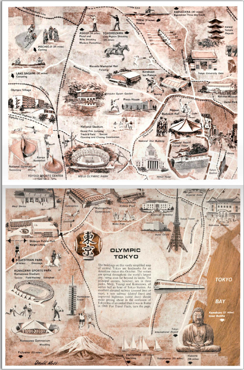
While researching for my book chapter, I just stumbled upon this amazing simplified map of Tokyo. It appeared in Sports Illustrated in 1964, and shows all the venues and points of interest for the visitor to the Summer Olympics, which took place here in October. You can access by clicking on “view this issue” (or try this link instead and go to pages 44/45). See below for a screenshot (click to magnify).
Several of the buildings on the map will be discussed in the upcoming book: Hotel Okura, Yoyogi National Gymnasium as well as Komazawa Olympic Park with its great stadiums. I wrote up a few facts on the Games here.
The photos preceding the map are gorgeous and the American tourism guide immediately after the map is worth the (cumbersome) read as well. From cheap taxis, road naming conventions, long nights followed by a Tsukiji fish market experience to buildings to be avoided for their apparent ugliness (Diet building, Tokyo Tower), the article is a great reminder of what has and what hasn’t changed since fifty years ago.
